FRO Trails Mapping, Parking and Entry Points
Famous Reading Outdoors (FRO) offers trail systems and lands that have become a treasured destination for ATV, Dirt Bike, UTV and Four-Wheel off-roading enthusiasts. Pennsylvania Off-Roading and a Leader in ATV Tourism. A Family-Oriented Recreation & Trails Park for Motorized Vehicles & Events located in Schuylkill and Northumberland counties in Central Eastern Pennsylvania. Famous Reading Outdoors is actively managing a family-friendly motorized recreation facility which require yearly memberships. Learn more – FRO site »
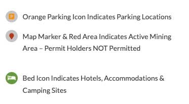
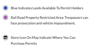
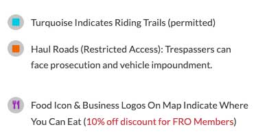
Famous Reading Outdoors Map Legend. Additionally, FRO MEMBERS/GUESTS are to ONLY USE the DESIGNATED PARKING AREAS when attending the park. Failure to comply may result in towing at your own expense. All Railroad property is private property and off-limits to all FRO permit holders. No riding anywhere around Railroad tracks.


LOT #1: BURMA TRAILS PARKING
From Route 61 go East on Hancock St. From the traffic light at Second and East Hancock Streets in St. Clair continue on East Hancock Street for 7/10 of a mile. Parking is wide spot the east side of the road. The roadway changes its name to Burma Road near this location.
Driving Directions (GPS coordinates: 40.7284137,-76.1784213) »
Burma tract offers trails suitable for ATVS, Dirt Bikes, Full Sized Vehicles and non-motorized vehicles. This tract offers both wooded and open land riding. This area is great for all levels of riders. In this tract of land there are various low lying areas where mud pits have accumulated. If you are looking to get dirty, this tract offers numerous mudding pits.
LOT #2 : DARKWATER TRAILS PARKING
From the intersection of Route 61 and Darkwater Road travel west on Darkwater Road to the top of the hill on the north side of the road. Parking lot is through the tire archway.
Driving Directions (GPS coordinates: 40.73122,-76.21322) »
Darkwater tract offers trails suitable for ATVS, Dirt Bikes, Full Sized Vehicles and non-motorized vehicles. This tract offers both wooded and open land riding. This area is great for all levels of riders. In this tract of land there are various low lying areas where mud pits have accumulated. If you are looking to get dirty, this tract offers numerous mudding pits.
LOT #3: LOCUST GAP TRAILS PARKING
From the intersection of SR54 and Marshall Road, travel approx. ½ mile on Marshall Road. Parking is down dirt road located on the left side of roadway.
Driving Directions (GPS coordinates: 40.762872, -76.449278) »
Locust Gap tract offers trails suitable for ATVS, Dirt Bikes, Full Sized Vehicles and non-motorized vehicles. This tract of land is primarily wooded. This tract of land is suitable for all levels of riders. This tract offers various low lying areas where mudding pits have accumulated. In the tract of land there is not much open ground for easy cruising. This tract is more suitable for those looking to ride in a more heavily wooded area.
LOT #4: ASHLAND MTN SOUTH
Coming from south of Ashland, take Route 61 north until it becomes Hoffman Blvd. The turn for the parking lot is on the right next to the car lot at 500 South Hoffman Blvd.
Driving Directions (GPS coordinates: 40.778806, -76.337167) »
Ashland tract offers trails suitable for ATVS, Dirt Bikes, Full Sized Vehicles and non-motorized vehicles. This tract of land is primarily wooded. This tract of land is suitable for all levels of riders. This tract offers mountainous terrain. In the tract of land there is not much open ground for easy cruising. This tract is more suitable for those looking to ride in a more heavily wooded area.
LOT #6: TOWER CITY TRAIL
From Interstate 81 going South: Take exit 107 (US209) toward Tower City. At the fork, keep right then merge onto US209 S. Travel 6 miles then turn left onto OA-325 W/S 10th Street, continue to follow 1.5 miles. Turn left onto Gold Mine Road, in .06 miles the Trail Head will be on your left.
Driving Directions (GPS coordinates: 40°33’56.3″N 76°32’14.4″W / 40.5656389,-76.5373611) »
From Interstate 81 going North: Take exit 90 towards Fisher Avenue. Keep left at the fork, follow signs for Lickdale/Lebanon, (150ft) turn left onto Fisher Avenue. Turn left onto PA-72 for 5.6 miles then make a left onto Gold Mine Road. In 6.4 miles the trail head will be on your right.
